
Product Overview
Application in Lateral from 4″ Diameter
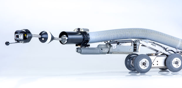
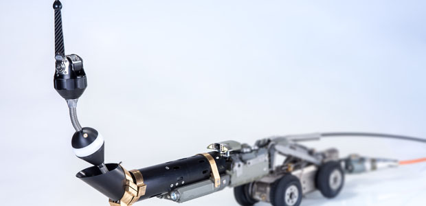
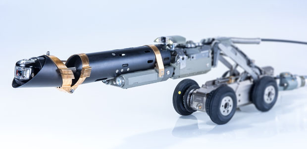
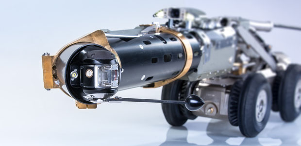
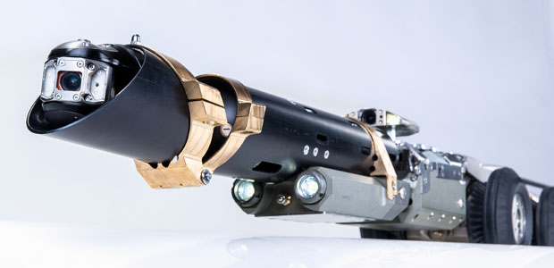
The Rausch USA LATRAS lateral tracking system upgrades the M 135 lateral launch system with a pioneering tracking sensor for the automatic measuring and graphic GPS mapping and documentation of the entire pipe lateral with the lateral camera KS 60 DB.
The system’s control electronics captures the movement of the LATRAS sensor head behind the digital lateral camera, KS 60 DB. The distance, position, and depth coordinates are registered constantly in parallel with the inspection and allow the documentation of the laterals at the same time without any significant additional work for the operator using automatic data logging software. With this new and important information about the pipe system mapped out on a GPS plane, the quality of the inspection is considerably improved.
All Rausch USA lateral launch systems with the KS 60 DB lateral camera can be upgraded with the LATRAS sensor and software package.
Features
- Operated through Rausch USA digital lateral launch system
- LATRAS sensor is positioned behind the lateral camera KS 60 DB
- Sensor records movement of direction and tilt angles
- Distance measurment with an incremental encoder with an error accuracy of less than 0.5%
- Real-time drawing of the pipe system with GPS
mapping and XYZ coordinates - Recoding of measurements for forward and backward movement
- Re-calibration of the measurement results through endpoints
- 512 Hz transmission sonde available
- Compatible with the lateral launch jetting nozzle for forward propulsion using water pressure
System Includes
A LATRAS upgrade includes the LATRAS sensor, LATRAS launching modules for the PM 135, and the LATRAS software package.
A new system includes the above in addition to the KS 60 DB digital lateral camera, Quadtro SAT drum with up to 550′ of cable connected to up to 150′ of lateral push rod, and the standard M 135 lateral launch modules: PM 135, SKM 135, and ZKM 135.

Request a Quote
Interested? Contact us for a fast, hassle free quote.